Photo Taken in Eureka Springs, Arkansas

Tuesday, April 25, 2023

cannabis

 marijuana is legal

never thought I would see that in my life


Friday, May 4, 2018

Another Map

Here's a map I really like because it shows what I believe. It's been a topic that's come up again recently and that is where the Ozarks' southern edge lies.

Personally, I say it's that hill right out of Conway as you're leaving to go north on Highway 65 where Pickles Gap is right over the top. You can't get much more Ozarks than that. It's all the way Ozarks from there on out once you top the crest of that hill.

It looks like the Ozarks. It feels like the Ozarks. I know I'm in the Ozarks. Therefore it's the Ozarks.

I've read or seen maps that show it's just south of Clinton. That makes no sense to me. I've never been able to wrap my head around that. That's so far north.

It's obvious you're in the Ozarks all the way to Interstate 40.

Perhaps there's a geological argument. I'm not going to get into that. I'd hate to lose because I'm just not buying it.

There's part of the Ozarks that are clearly in "The Ozarks" that look like they shouldn't be, so there ya go.

Here's the map I randomly found. I wasn't even looking for it. At least with this one, I've linked it to its original source since I neglected to do that with the first map I posted ages ago.

The Map I Agree With For Taking The Ozarks So Far South

There you have it. If I knew the other regions as well as I know the area I live and roam about in, I'd be able to know if I felt as strongly about where their delineation lies.

Tuesday, November 21, 2017

Missouri State University and Maps

I received an email from a couple of folks who work at Missouri State University up in Springfield asking about a map I posted on here quite sometime ago. I honestly couldn't locate the source, which isn't like me and it no longer shows up in search results or through tineye.com, a reverse image search engine I've found incredibly useful in the past.

He included quite a nice map of his and I asked his permission to post it here and he gladly obliged.

His name is Jim Coombs and he is the Maps & GIS Librarian at Missouri State University. I'm sure he'd have no problem helping you with any questions you may have about maps of the area. This is a link to his Maps & GIS Unit’s webpage.

Sunday, June 11, 2017

Table Rock Lake

Photo I took the other day of Table Rock Lake from Cape Fair, MO. The lake is so incredibly big and this is just a small, very small, part of it. It's up near the Flat Creek portion.


Friday, December 23, 2016

Diggins

We have a new kitten. His name is Seymour Diggins, but he goes by Diggins for short.

He's named after two Missouri towns deep in the heart of Amish country. He is a country kitten. He lost his Mommy when he was very young.

When we brought him home, he was about the size of a teacup.

He's got the most amazing personality. I just love him to pieces.

 
Here he is lounging.

Thursday, April 14, 2016

Calico Rock, Arkansas

I like to take drives in the Ozarks on my days off from the hotel. On Monday, I made it all the way down to Mountain View. It sure has a pretty downtown made up almost entirely of stone buildings. I didn't take a picture of it this time, but I will on down the road. The town sure earns its name because there are mountains in every direction.

On my way home, I ventured through a town I'd never been to before, Calico Rock, which apparently has quite the history. Once I came out of the mountains into the meadows, there were cliffs that appeared to my right and in front of me. I saw a couple of houses built on the cliffs to my right and I really liked how different it looked.

Well, that was nothing. Before I came to the bridge that crosses the White River and separates Stone County (Mountain View) from Izard County (Calico Rock), I saw the town laid out on the cliff complete with an old-fashioned water tower. I think it stopped me in my tracks, well, at least mentally. If I wasn't driving, I would've stopped instantly. I'd never seen anything like it before in my life. It was just so cool.

Then right as I crossed the bridge I saw the downtown and I swear I felt transported back over a hundred years ago. One of neatest downtowns I've ever seen. Love the architecture. The whole town ranks as one of the most unique towns I've ever visited.

I won't go into the colorful history or the ghost town within a town, Peppersauce Alley, because there's plenty of it on the Internet that can be readily had. I'll just share my photos.


I didn't feel like taking any photos downtown because I felt too overwhelmed with where to start. Maybe another day. You can see a glimpse of the downtown behind the White River - Izard County sign. Behind that first building is Peppersauce Alley.


The meadow between the mountains and Calico Rock.


This is where I ate the most amazing Mushroom Swiss Burger ever!

I want to spend more time in the town poking around. I especially want to see those downtown stores and maybe venture deeper into Peppersauce Alley.

Wednesday, December 2, 2015

Whoa...

...I just realized it's been almost a year since I've made a post. Here's a random picture to show I'm still around. It's from my mountaintop.


Sunday, January 11, 2015

Frozen Mountain

When I was driving home from work yesterday morning I had a hard time taking my eyes off of the 8 that was showing for the outside temperature until I rounded the bend into Cape Fair and saw my frozen mountain. This is the best spot where you can see the Ozark hill I live upon.

It's not snow. It's just frost that coated the earth white on the high spots.


Bridgeport is a lakeside resort. The bridge you see is Highway 76 crossing Table Rock Lake.

Monday, January 5, 2015

First Snow and New Additions

We finally had our first snow yesterday and it didn't consist of much accumulation, but it sure was pretty falling.


You can really see the snowflakes much clearer in this one.


This is what most days this winter have looked like.


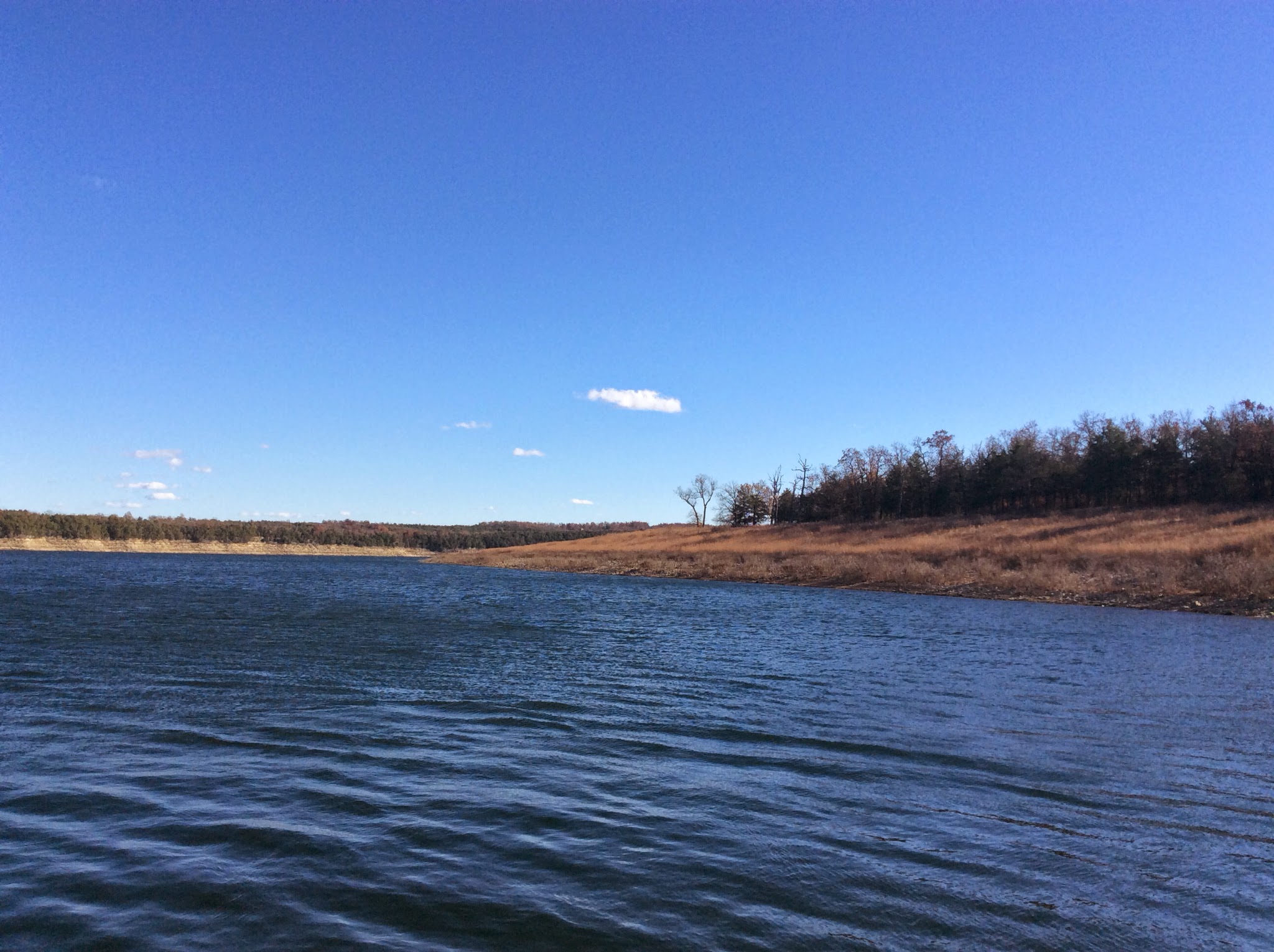
The woods above and Table Rock Lake below.


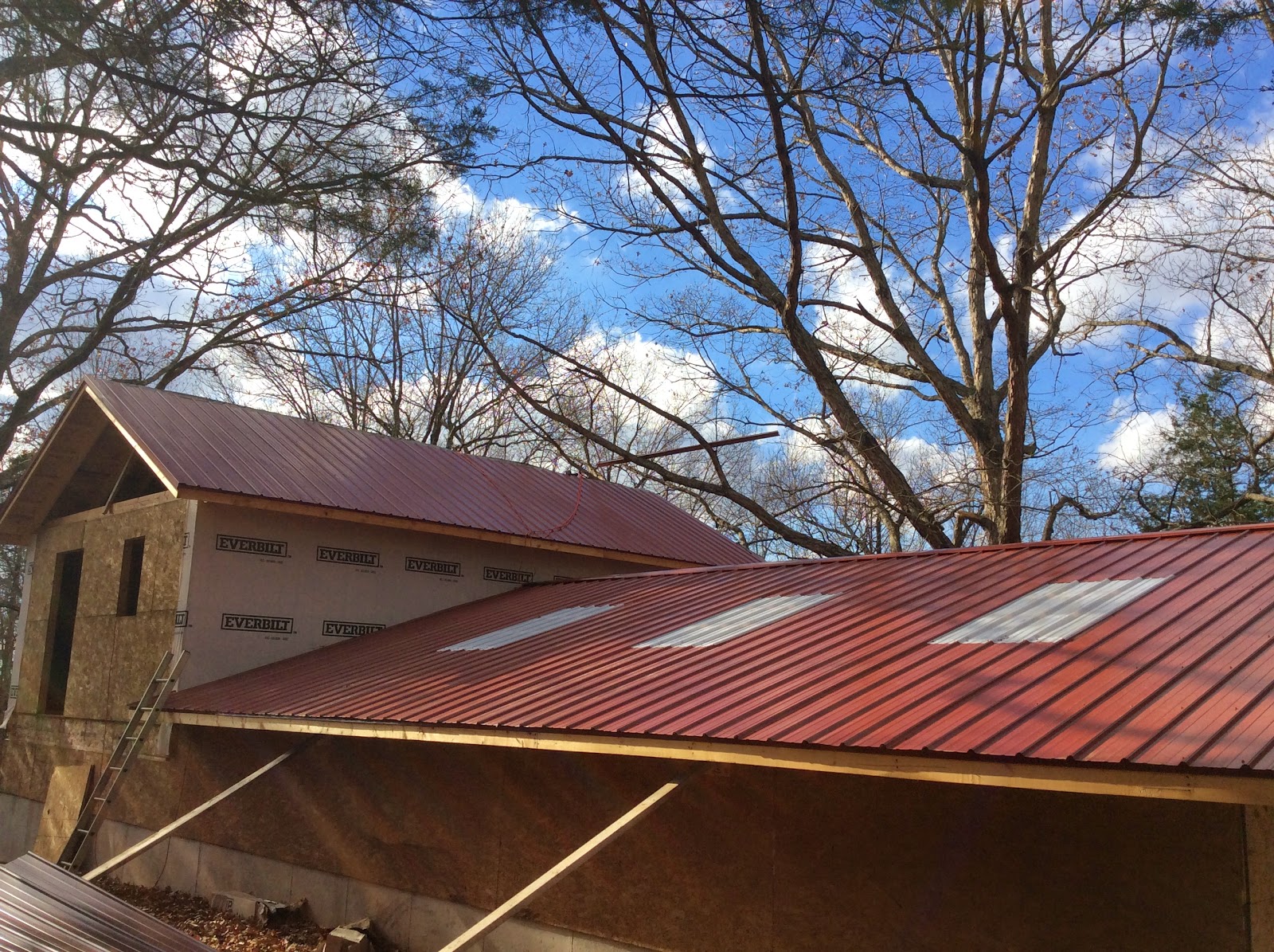
Considering the weather, the new additions aren't regarding the shop/house build, but rather to some new fur friends that have joined the household.

First, we have Samantha, a calico kitten, and Lily, a Yorkie mix. They are both from the Stone County Humane Society. John and Lily are BFFs and can't be separated. Samantha is like a parrot and sleeps on my shoulder or chest/neck. I've never seen such a cuddle monster of a cat in my life. They've been here since November.


I guess since they came home together, they bonded.


They spent the whole first day in bed. Samantha spent most of it under the covers where she still loves to sleep. They even ate together in the beginning.


Then a random new addition from this weekend is Vince. John named him. He's the hotel kitty.

We get strays in Branson that come around the hotel. Most of them won't let you within a mile of them, but this black and white kitty would let you pet him and he'd come running whenever he'd see me at work. A hotel guest bought a box of cat food and when it ran out, I brought in some cat food from home. My coworkers would put out sausage and eggs from breakfast for him.

I couldn't take it anymore and figured this is no life for a kitty and brought Vince home. He spent the first day on the shelf in our pantry adjusting. Now he's out and about and he's playing!


It's a new year. Happy New Year! May all you dreams come true this year.


Tuesday, December 16, 2014

Rustic

I've been meaning to post about the roof, but I've been slacking. The color is rustic. I love metal roofs and here's a pic.


The white in the shop are skylight panels and I must admit I like their look much better from the inside than the outside.

Wednesday, November 26, 2014

Peel Ferry

I don't believe I've posted about the ferry that runs between Missouri and Arkansas across Bull Shoals Lake. You get to it by going to Protem, MO or Peel, AR. They're both little out of the way places on the western side of the lake, not too far from Branson or Harrison. I like it because it's different. How often do you get to cross water on a ferry? Not often. And it's free.

I'd taken pictures of the Peel Ferry before, but I never got around to posting them. I know I don't see it show up in my list of Tags or in the Search Box. It's nice when another time comes around to do things you wanted to do before.

This is what the lake looked like when we pulled up on the Protem side. The ferry was on the Peel side when we arrived. The white speck off in the distance is the ferry dock on the other side, the Peel side.


Here's us waiting in our Avalanche. The sign looks a little bent up. It's windy here at Bull Shoals. Word has it that it's always like that. The ferry is ran by The Arkansas State Highway and Transportation Department (AHTD).


The ferry approaches our side.


Taking off.


Out in the water.


We had a good conversation with the first mate on deck. Boy, did he have a traditional Arkansas accent. His dad worked on the ferry and now he does. He grew up down the road in the Peel area. I should've asked him for his pic. I almost did.

We got into a great exchange over the various crossings over the tri-lakes and he had a good one to share. Way back when him and his buddy were dating girls on the Missouri side. The boys had missed the ferry to get the girls home and had to drive the 100 miles around to cross at Bull Shoals dam. That's a good story, especially when you're sitting on the ferry looking over at Missouri on the north side and Arkansas to the south and they're not too terribly far apart from each other. But when there's water between, not much you can do.

Here's Missouri.


Here's Arkansas.


We're approaching our destination.


The captain or pilot.


You reach the Peel Ferry from Highway 125.